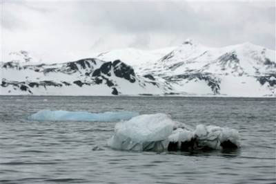
 OSLO (Reuters) - Jagged mountains the size of the Alps have been found entombed in Antarctica's ice, giving new
 clues about the vast ice sheet that will raise world sea levels if even a fraction of it melts, scientists said on Tuesday.
Using radar and gravity sensors, the experts made the first detailed maps of the Gamburtsev subglacial mountains, originally detected by Russian scientists 50 years ago at the heart of the East Antarctic ice sheet.
"The surprising thing was that not only is this mountain range the size of the Alps, but it looks quite similar to the (European) Alps, with high peaks and valleys," said Fausto Ferraccioli, a geophysicist at the British Antarctic Survey who took part in the research.
 He told Reuters that the mountains would probably have been ground down almost flat if the ice sheet had formed slowly. But the presence of jagged peaks might mean the ice formed quickly, burying a landscape under up to 4 km (2.5 miles) of ice.
Ferraccioli said the maps were "the first page of a new book" of understanding how ice sheets behave, which in turn could help predict how the ice will react to global warming.
Antarctica, bigger than the United States, has been swathed in ice for about 35 million years, and
 contains enough of it to raise world sea levels by about 57 meters (187 feet) if it ever all melted. So even a fractional melt would affect coasts around the globe.
"Unless we have a basic understanding of how ice sheets work, any sort of predictive model won't match reality," Ferraccioli said.
 The U.N. panel on climate change says that greenhouse gases, mainly emitted by burning fossil
fuels, will bring more heatwaves, floods and droughts, and raise sea levels.
The team of experts from Australia, Britain, Canada, China, Germany, Japan and the United States also found water below the ice, using survey aircraft that flew 120,000 km (75,000 miles).
"The temperatures at our camps hovered around minus 30 Celsius (minus 22 Fahrenheit), but 3 km (2 miles) beneath us at the bottom of the ice sheet we saw liquid water in the valleys," Robin Bell, of the Lamont-Doherty Earth Observatory at Columbia University, said in a statement.
Many sub-glacial lakes have been found in Antarctica in recent years.
Geologists say that mountain ranges such as the Alps or the Himalayas form in collisions between continents. The last time Antarctica was exposed to such forces was 500 million years ago.
"The mystery here is that the Alps are only 50 to 60 million years old, while here we have a mountain range that may perhaps be as old as 500 million years," Ferraccioli said.
No comments:
Post a Comment